New Discoveries at Water Sinks, 2008
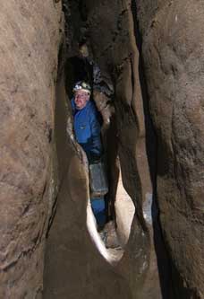
The Water Sinks Subway, Part 2
Last Update: 15 February 2011
Survey Trips: LS | SP | DC | HH | DD | HT | KW | SB
Other Trips: Geology | Camera Installation
There is a line map and profile at the bottom of this page.
Complete 2007 Trip Reports
|
Water Sinks and all of the caves in and around it belong to Phil and Charlotte Lucas. Exploration and mapping of caves, here and elsewhere, has been Phil’s life-long passion. It has been my privilege to be involved in his Water Sinks project in a modest way. JRS
|
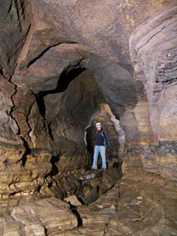
Water Sinks is a huge sinkhole that is shown and named on the Williamsville topographic map. It is dry most of the time but takes a large amount of water after a heavy rain. There are three caves in the Sinks, two of which have been well known and mapped for decades. The third, which is really a part of Water Sinks Cave, was discovered and mapped in late 2007 and was the subject of Part 1 of this report. The current report, Part 2, takes up with new explorations beginning in January 2008, after a brief historical digression.
|
|
|
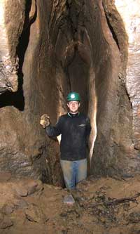
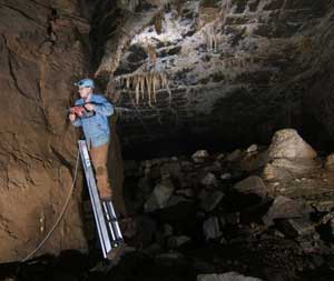
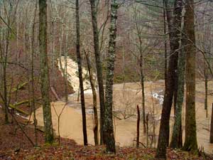
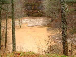
19 November 2003: Early November 2003 was fairly wet, then 2.6" of rain fell in an 18-hour period starting at 1800 on the 18th. This is the result. At very high levels Sinking Creek overflows its banks in the meadow area before reaching the main sinkhole. Some water flows into the entrance of Owl Cave, on the upstream side of the ridge in the center of the sinkhole. The left photo shows water pouring out of the Owl back door on the opposite side of the ridge. The right photo shows the main cliff face which contains the several entrances to Water Sinks Cave, most of which are under water. If the culvert entrance to the Subway passages had been in place at that time, the lid would have been under roughly 23 feet of water! Photos by Phil Lucas
|
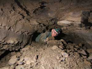
4 January 2008: The Lickety Split Survey – Scott Olson, Tommy Shifflett and Phil Lucas, reporter. Also John Sweet and Doug Stanley were in the cave today on other business. It was about zero this morning in the bottom of the Water Sinks – we did not get off to an early start. But as we finally approached the cave we noticed a large patch of frost about halfway up the hillside about 300 feet southeast of the entrance. This marked the location of the Radio Dig where air flowing from Owl Cave makes its way up through breakdown and out to the surface between cracks and fissures. The moist cave air was freezing on all surfaces around the blow hole with a white frosting. Many years ago we placed a radio boom box at the blowhole and we went into Owl Cave to a location where we could hear the radio playing on the surface. Although we made a couple attempts at digging, no human-sized entrance was ever accomplished. At the time, we did not consider if there might be other sources for the air flowing through here. But I remember crossing a deep very narrow fissure in the Radio Dig passage. Could this fissure intersect a Subway passage down deep below?
With that thought, I asked Tommy to climb the hillside to the blow hole and for Scott to stand by the entrance lid to the Subway. I positioned myself to where I could see both and provide communication. As the lid was raised the outside air would rapidly flow into the cave. So, I yelled back and forth for the lid to be raised and lowered to see if it would have an effect on the air flow at Radio Dig. Tommy reported that it did. He noticed a slight increase in air current. Also he observed moisture quickly accumulating around the blow hole when the lid was raised demonstrating that more moist air was reaching the surface. The air current at the Radio Dig is very small compared to the Subway entrance air but there does seem to be some sort of a connection between the two caves.
About this time John Sweet and Doug Stanley showed up to spend a few hours in the cave. John and I had talked about conducting some crude air flow observations within the cave. Where does the air that blows into the Subway go? This is a puzzle. After owning the property for 20 years and carefully searching the hillside for blowholes, I feel pretty certain that it does not come out on my property or anywhere close by for that matter. So John and Doug, armed with a lighter and pieces of cardboard to make smoke, set off to trace the inward-bound cold air currents. Their tracing showed that part of the air is flowing down Sweet Dreams and up the lift tube into the breakdown. Another flow of air is down into the Roaring River Passage. So this is but another reason to return down into this most interesting passage.
Tommy, Scott and I came equipped with rope, ladders, hammer drills (two!) and all sorts of paraphernalia to do climbs and passage enlargement. The first was a climb at the end of the Brass Monkey Passage where I though I might have heard an echo from a canyon up above a steep mud slope. While making an initial assessment, Tommy found a crawlway that led upward into the overhead passage making the climb unnecessary. Unfortunately it did not continue very far before becoming too small.
Next we backtracked to the Durn Tootin side passage and lugged our gear down to where we had ended our previous survey with a narrow, too-tight canyon. A passage intersection could be seen ahead and there were good echoes. Just before this point, I placed several bolts to make a climb at the top of a keyhole a bit easier. Finishing this task we were single file in the narrow canyon going to the final restriction that I intended to make larger. Problem was Tommy was in the lead and I forgot to tell him exactly where it was. So I was bringing up the rear behind Scott when I realized that they had already passed the restriction and were standing in the intersection. Admittedly, the tight spot was not all that much smaller than most of the canyon so I exhaled and went on through anyway. Of course, I had to endure several minutes of Tommy saying how he thought it was all plenty big enough and how was he supposed to know where it was.
Still thinking about that trade route, and looking at two hammer drills we had brought with us, I suggested that we spend a few minutes making it bigger anyway. Well, the few minutes was actually more like an hour or so but Tommy’s new drill still was a joy to use with all those lithium-ion batteries, so enlarge the passage we did. Leaving Scott on the entrance side of the passage, we did the drilling from the cave side where there was more room. The passage is so big now that Tommy almost doesn’t have to turn sideways.
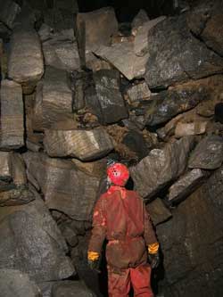
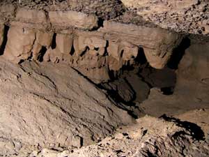
The intersection sported a choice of equally inviting passages going in opposite directions. We chose right. This was heading to the southeast toward the lower end of the Water Sinks, a promising direction with air. So we surveyed Lickety Split. Well, not really because I kept stopping to take some pictures. The passage reminded me of those in the old upper Water Sinks Cave, tall and somewhat narrow, but generally comfortable walking. We came to several intersections but stayed in a southeast trending direction. After about two hundred feet we came to a steep sided room with massive beakdown. The entire breakdown had been washed clean and scoured with flood water coming down from above. Some of the breakdown blocks were very large and the whole pile did not have the mud and clay “cement” to help hold it together as is often the case. Several large chunks in the ceiling seemed to have no visible means of support. Quite frankly, it looked pretty scary. We tip-toed softly across one side and placed a survey station. There was a steep climb in the ceiling but I think it would be madness to attempt it.
To scout a route beyond, Tommy disappeared from view into the floor between breakdown blocks. A few nervous minutes later he returned to say he had found a way down but we would all need to be careful. This was wasted breath as far as I was concerned and we slowly picked our way down surveying cautiously. Soon enough Tommy (lead tape) called back that he was at the top of a cobblestone slope that led down to a small hole blowing air. Scott looked at me and said, “Could this be the Sweet Dreams lift tube?” It was and so we completed a loop within the cave’s passage but confronted yet another mystery – where does the water go? There is obviously a lot of water entering this room during flood conditions into the top of the breakdown. The lift tube carries enough flow during flooding that it pushes cobbles up a fifteen foot slope. And the flood waters flow through the passage that we surveyed today into this area. But where does all this water exit? Air currents flow in the same directions as the water and it is probable that it is following the
same unknown passage.
Not far from this connection is another tall narrow canyon leading away from the breakdown in a northwest direction toward the entrance. Being able to get through was not certain and naturally Tommy tried it first. Naturally he did and then there followed a lengthy discussion about what he was seeing on the other side. The canyon is approximately 30 feet high but only widens slightly, in some spots wide enough to accommodate cavers. Along its sandy floor seemed to be the best place and where Tommy crawled through. I gave it a try. All went well for a short distance and then despite frequent exhales and a lot of squirming, my forward progress stopped. Suddenly, I realized I had forgotten to remove my survey notebook and it had me jammed. Cussing under my breath I slowly backed out. There was even more discussion as to the worthiness of continuing. I tried again without the notebook – no problem this time, despite a very snug fit for about 20 feet. Beyond was about 150 feet of narrow clean canyon passage and then we made yet another tie into the previous survey into the Sweet Dreams section. Both ends of these surveys had been sketched by Mike Ficco and accurately described during the previous survey. Our survey today totaled over five hundred feet and left seven leads. The new part of the cave is now over a mile long. Phil Lucas to BCCS, e-mail.
10 January 2008: The Slim Pickens Survey – Al Grimm, John Sweet, and Phil Lucas – Preliminary report by John Sweet. Into the Subway on a rainy day. Well, it was not really very rainy but it was threatening when we entered and had rained a little when we emerged. Still, it is kind of eerie to be in a passage that frequently fills to the ceiling with water and to know that it is raining outside. We finished off some side leads left over from the LS survey last Friday, completed a small loop, then took off from station LS7 for parts unknown. This passage transitions from canyon to low, gravelly crawlway, then back to canyon. It begins 50 feet in elevation above the downstream end of Sweet Dreams and trends generally south to southwest and going downhill until reaching a low point in the gravel crawl, then upward again. It lies entirely to the east of previously known cave. I was ready to quit at the gravel crawl but, fortunately, Al “Groundhog” Grimm persevered, pushing enough gravel aside that we could get through. I have been rather nervous about tight places but I think I’m getting past that hangup somewhat.
We surveyed 823 feet and stopped in large, going cave due to time constraints. This point is in Down Yonder country, about ten feet above the main DY passage but poised to intersect if it continues southwesterly. The total surveyed passage is now 6470 feet. The next trip is planned for 15 January. Phil’s report with photos follows. JRS
The weather forecast was for rain to begin after noon today and the heavy rain to arrive later. Hum, best not to tarry. We planned to be out by 3:00 – ought to be soon enough. The destination was down to the Sideways Passage beyond where we made all those passage enhancements last week and then to knock off the side leads. Good plan but these side leads seemed to be bounded by the edge of the huge Water Sinks sinkhole on one side and known cave on the other. It might be slim pickings for a lot of passage.
We first chose the northwest-trending passage heading back toward the entrance. We didn’t go far until we encountered massive breakdown with clean washed sides. Sure enough, this is the edge of the entrance sink. We could not seem to make much progress in attempting to penetrate this collapse nor did we expect to. So heading back down the Sideways Passage we continued to survey each short lead with none going very far. Eventually we got to the next-to-last intersection. Choosing the left passage, to the northeast, and crossing a hole in the floor, we came to the Scary Breakdown Room and tied into the previous survey. Then we turned in an upstream/up-slope direction in the passage leading into the Scary Breakdown and started a survey extension from last week’s survey. The walking passage meandered gently upslope out of sight. It started out looking good but how long would this continue? Fifty feet, then a hundred – it kept going. Lots of small side leads branched from nearly every predicted joint intersection. The floor is a combination of sand, fine sediments and small cobbles. There was a steady drift of cold air flowing down the passage. And it kept going in a generally south and southwest direction. Finally after 150 feet of nice passage the bedding took a downward turn to the southeast and so did the passage, quickly becoming lower till it became a cobblestone belly crawl going down slope. It was another lift tube.
Groundhog Al slid down and spent several minutes rooting through the cobbles and sand until he passed from beneath the belly of the tube. The other side was a nice hands-and-knees crawl that went again upslope but more steeply than before. The survey footage accumulated as we made steady progress up the crawl and the passage kept getting bigger. But the afternoon kept getting later. About 1440 we called it quits with over 800 feet in the book, in passage 10 feet wide and high that continued. Returning to the surface took 30 minutes. The afternoon rain was falling as the weatherman had predicted. But it was a nice passage where we turned around. Oh well, it gives us something interesting to look forward to. Phil Lucas to BCCS, e-mail.
Postscript: It rained 1.4" overnight in Mustoe, a few miles to the west, but perhaps less at the cave. The creek rose higher than shown in the photos from last December, with maximum pond level a couple of inches below the top of the entrance culvert. This was the highest flow since the flood that opened the cave last October. JRS
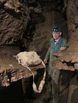
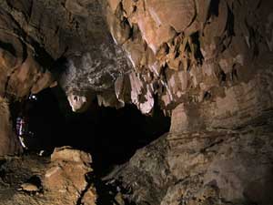
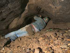
The last station marked by flagging tape on a rock pinnacle.
Note the blackness just beyond . . . .
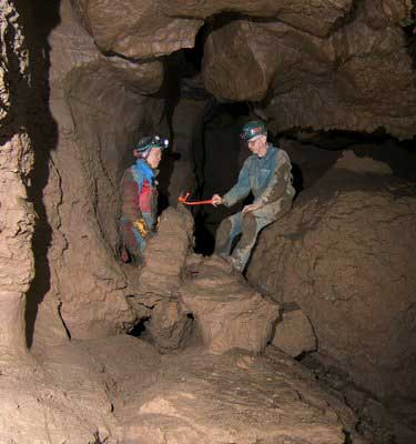
15 January 2008: The Double Cross Survey – Al Grimm, John Sweet, and Phil Lucas – Report by John Sweet. It is amazing where one little insignificant-looking lead can take you. This was the fourth survey trip into the Sideways Section of the Subway. It started back in December with the Durn Tootin survey, which was stopped after surveying 320 feet by a fissure that was too narrow. That obstacle was overcome on 4 January when the fissure was widened and 565 feet was surveyed. We went back on 10 January to tie up loose ends but instead surveyed 824 feet with no end in sight. So here we go today, again planning to tie up loose ends.
As noted previously, the end of last week’s survey lies slightly above the Down Yonder section, so the first thing we did was go look around in that area to see if there were any up-trending crevices that had been missed. We saw nothing likely looking so we returned to the little tube leading to the Sideways Section. Before reaching the station where we started off last time, Phil said, “Let’s knock off this little passage to the right before going on.” Why not indeed? It looked like it would end soon and we could move on to our objective. It got tight but did not end. Al squirmed through and reported an intersection and walking passage. I did not much like the tight spot and there was certainly no room for three people to survey. We determined that it led back into known cave so I went around while Al and Phil surveyed through.
|
|
|
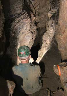
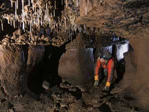
An interesting ceiling – glad it is not the floor and we have to crawl over it!
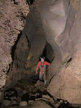
Al Grimm skirting some soda straws. All photos by Phil Lucas
|
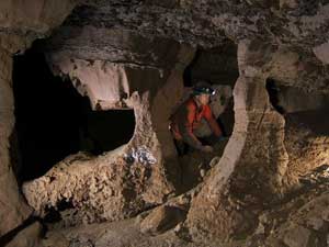
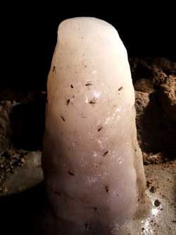
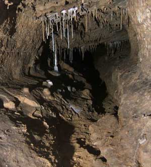
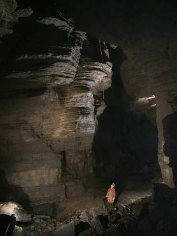
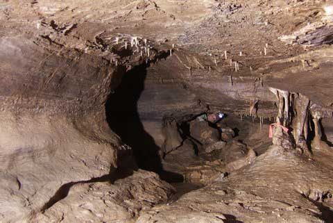
Once through, instead of closing the loop, we set off into new territory. It was pretty nice passage most of the time and eventually led to a small room with interesting erosional features, including three columns holding up the ceiling, which we called the Colonnade Room. Continuing, we arrived at a T intersection, where a fissure went to the right and a smaller passage went up and to the left. I was taking the lead, setting stations, followed by Al reading instruments and Phil taking notes. I went right, climbing down and under a breakdown block for a short shot, then moving out along the fissure until the floor suddenly ended in inky blackness, where I waited for Phil to catch up. “Watch this rock,” I said, dropping a fist-sized rock into the void. Silence. A larger rock made enough noise to tell us that it was a fair ways down. Then we push a boulder over the edge, which ricocheted once then landed with a thud on a muddy floor. Around fifty feet we decided, then tried my laser measurer to see if it could pick up a signal off the floor. Forty-eight feet it turned out. We surveyed out to the edge and looked for good sites to set bolts on the next trip. The void returned a big echo, which led us to wonder if we were looking down a ceiling crevice into the main passage. Al rolled out 30 feet of survey flagging, tied it to a rock and dropped it down the crevice.
We retreated to the junction and surveyed to the left and upward, squeezing past some white soda straws into a small room, then on to a low passage with more soda straws. We could have pushed on but not without doing damage. The tracks of a raccoon were seen in the mud on the floor of this passage. Al probed a clay-floored crawl that might bypass the formations but it became too small. We decided to return with a shovel and try to dig out the bypass rather than break formations. It was getting late anyway and we had not even reached our main objective, station SP38, where we had quit last time.
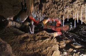
Al squeezing into the Soda-Straw Room, above.
The formations we do not want to break and hope to bypass, right.
|
|
We retraced our steps, turned right, went through the gravel crawl and arrived at the point we had set out for over six hours earlier. Here we had two choices and decided to go right. After about 100 feet it turned sharply upward. We surveyed to a breakdown plug but left several other leads untested. We had been in the cave nearly eight hours and felt that was enough. Our loose-end-tying trip left more ends loose than it tied.
Once the data was plotted it showed we had surveyed 1010 feet, bringing the Sideways Section to 2720 feet and the Subway as a whole to 7480 feet. The last piece we did passed entirely over the Down Yonder section. The potential bypass of the soda-straw passage is now the highest point in the cave and the only part above the survey datum outside the entrance. On our way out we walked down the main passage and found a strip of survey flagging hanged from a ceiling crevice right at the entrance to the Brass Monkey section. We had seen that crevice before but there is no way to tell from below whether it connects to anything. Now we know that it does. Surveying down this drop will close a huge loop. JRS
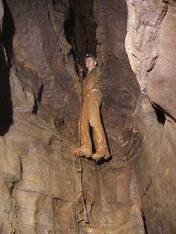
Al looking up at the flagging tape hanging out of a ceiling crevice,
junction of the main passage with the Brass Monkey section.
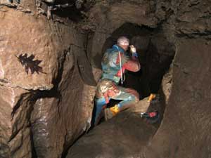
19 January 2008: The Hem and Haw Survey – Tony Canike, John Sweet, and Phil Lucas – Report by John Sweet. Also on the trip were Scott Olson and Keith Christenson. Scott, Keith and Tony were staying at the Butler Homestead while I was coming over from home, all meeting at Phil’s around 1000 to 1030. Phil named the survey based on what he surmised would happen when the group gathered to plan the day. The name was off to a good start when the Homestead group did not arrive until nearly 1100, which left Phil and I hemming and hawing for some little while. To their defense, Scott was having trouble with his Omegalight. [Aside to Benjamin — expect a small package in the mail.] Phil solved that problem by loaning Scott another light, after which the trip got underway pretty quickly. The plan was for me, Tony, and Phil to be a survey party. Scott and Keith were to go into the same area and try to open a sediment-plugged passage in hopes of bypassing the Soda-Straw Crawl [see previous report].
Keith and Tony had not been in the Subway before so we started out with a trek down the main passage and a look at the survey tape hanging from a ceiling crevice [see previous report]. We then doubled back and headed into the Sideways Section, taking the Double Cross passage, surveyed just a few days ago. At the Colonnade Room we split up, the diggers going ahead to the Soda-Straw Room, while the surveyors “tied up loose ends.” This time it worked out as expected, there being no great length to any of the side leads.
The first side lead went for about 160 feet in 11 survey shots, ending in two breakdown chokes. The second gave pretty much the same result. The digging crew returned as we finished up these two passages. They had not broken through but had opened up two crawls somewhat. The hoped-for bypass of the Soda-Straw Crawl seemed not to be going in the correct direction. Scott and Keith headed out to the main passage to take some photos while we, the surveyors, went on to deal with new booty.
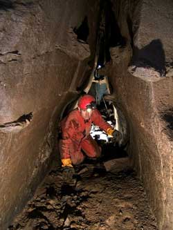
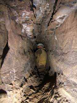
Returning to the Soda-Straw Room, we first did a short crawlway to the left that ended in three shots. With no bypass available, it was now time to tackle the Soda-Straw Crawl. The goal was to get through with minimal damage to the formations. I went first and determined that there was indeed passage to survey, so the others followed. A much-too-tight crevice continued straight, while a passage to the left ended in sediment fill. To the right was a sinuous, tubular passage 3 to 3.5 feet high by 15 to 20 inches wide with some air movement – commodious enough just to traverse but it made for tight surveying. To make matters worse, it got smaller as it went.
I led, setting stations while backing down the tube, since it was very difficult to turn around. Tony followed with the instruments, and Phil brought up the rear taking notes. After just a couple of shots we heard footsteps and voices echoing in the distance. Several loud “Helloooowwwws” brought no reply and soon the sounds faded away but we were now sure we were heading toward another ceiling crevice and that we had heard the other crew down in the main passage. After seven shots and about 70 feet, with continued narrowing and no end in sight, the cramped quarters were working on my head so we opted to quit. Tony also seemed pleased at the thought of more open spaces while Phil, with the largest girth in the group, would have happily pushed on. The Echo Tube remains for a smaller, or at least less claustrophobic, survey team. A two-man team would be ideal for this passage.
|
|
|
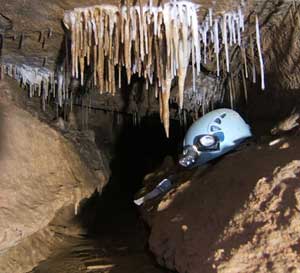
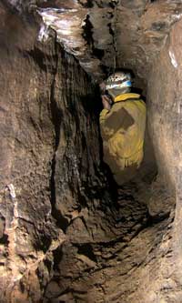
Two views of Tony Canike reading the compass in the Echo Tube.
|
On the way out we made voice contact with Scott and Keith through the previous ceiling crevice and learned that they had been in the side passage leading to the Roaring River, so our unfinished passage will probably connect to a ceiling crevice in that area. The survey plot shows it headed in exactly that direction. Backtracking through the Colonnade Room to the main junction, we surveyed two more short side leads off the Slim Pickens passage before leaving the cave. We had surveyed 588 feet in just under nine hours, bringing the total to over 8000 feet. Several of our leads terminated in what has become a straight line of terminations on the southwest, which corresponds to the edge of the hill overlying the cave. These are the highest passages in the cave, being near or above the level of the entrance. The areal extent of the cave is now pretty well defined unless we can make a breakout to the east, toward Chestnut Ridge, or somehow get through or under all of the collapse areas.
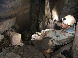
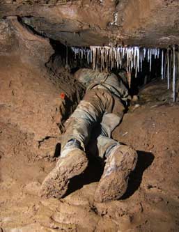
22 January 2008: The Dragon Diarrhea Survey – Rick Lambert, John Sweet, and Phil Lucas – Report by John Sweet. This was planned as a short trip, meeting at Phil’s at noon, and, as it turned out, we were all glad it was short. We set out for the Brass Monkey section with the intent to survey beyond the short-ladder drop described in the Nick-of-Time survey report and, if time permitted, to check a couple of leads below the drop that the NT survey had passed up.
|
|
|
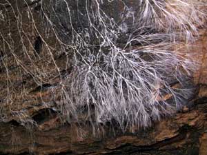
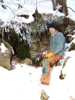
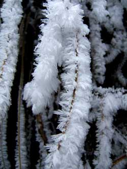
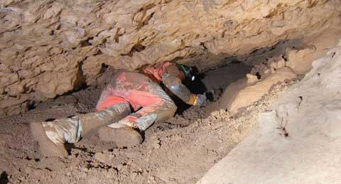
Before entering the cave we checked out a spot called the Radio Dig, where warm air exits the cave. It is known to connect into Owl Cave but is too tight for cavers and it may also connect to the Subway but this has not been positively determined. Rick Lambert at the opening, left, and hoarfrost formed on twigs by the moist air. Compare Rick’s clothes to the “after” photo, below. All photos by Phil Lucas
|
This section of the cave is well known to be wet and muddy and it started off as advertised. Our first survey shot took us from the top of the ladder drop across a floor crevice too narrow to enter to a T intersection and a slimy down-climb of ten feet or so. The left lead at the T went steeply up for a short ways until it pinched out and the right lead sloped gently downward but with the same result. With minimal booty there, we backtracked, rigged the ladder, and descended to a pool of water and a muddy tube passage with a trickle of flowing water.
The first lead was a low crawl to the right that turned back to the known passage in only two shots, so we closed a short loop. I then started up a lead to the left behind some formations. It was about a foot-and-a-half high, three feet wide and sloped slightly upward with a trickle of water on the floor. The solid-looking floor was actually a thin crust that covered a thick layer of orange mud about the consistency of mayonnaise. My elbows, knees, and toes broke through the crust as I crawled but I was able to stay mostly out of the mud. Rick followed with the instruments and Phil brought up the rear with the notebook, each breaking up more of the crust. My turn to sink deeper came as the ceiling lowered to one foot and the slope steepened slightly before emerging into a small room floored in the same goop.
Rick starting into the Dragon’s Diarrhea crawl, just at the beginning, before it got bad.
Oddly, no photos were taken farther along . . .
Once in the room I looked up through what was surely the too-narrow crevice we had looked down a short time ago. The proof of that was a broken stalagmite that had fallen down the crevice as we crossed and which now lay in the mud before us. The crawlway extended only a mercifully short way beyond. This had started out to be, for no particular reason, the Dragon Tail survey but we renamed it more descriptively at this point. Going out was downhill and the crust was fully destroyed so it was a swim in six inches of slimy goop. Back in the tube passage Phil asked if I wanted to see where it went and check one more lead but I was already on my way back to the ladder as I shouted a resounding “NO!” I do want to do that, of course, but not right now!
|
|
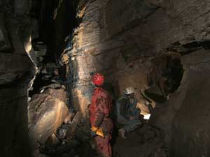
|
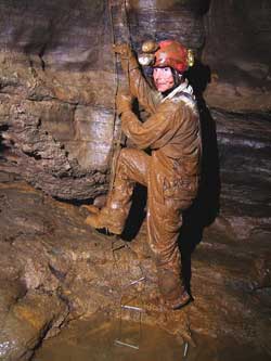
John near the top of the short-ladder drop and Rick ready to start up. The mud is loaded with göthite, a hydrous iron oxide, which causes the orange color. There are also göthite formations in this area of the cave.
|
We ascended the long-enough ladder at the short-ladder drop, each burdened with 20 pounds of added goop, and stopped long enough to take one survey shot down the too-tight crevice to close that loop. Phil didn’t even open the notebook. We just memorized the three numbers and headed for the entrance. The inside of the entrance culvert is now plastered with mud so the next crew will get dirty right at the start. On the way out Phil commented that, while it is normally pretty clean, “This cave really knows how to get muddy when it wants to.” At 282 feet this was the shortest survey to date and certainly the ugliest.
27 January 2008: The Hither and Thither Survey – John Sweet and Phil Lucas – Report by John Sweet. Phil and I decided to make a short trip on a Sunday afternoon and check out a few unlikely looking side leads that had been left on the survey of the Sweet Dreams passage last November. I also wanted to photograph a small pothole in the floor of this passage that had recently acquired a good-sized rock as a tennant.
|
|
|
A small pothole in the floor of the Sweet Dreams passage near station HS9. The left photo was taken on 11 November 2007, during the HS survey trip, while the right photo was taken on 27 January 2008, during today’s survey. The rock is about a foot and a half long and must weigh at least 20 pounds. It was moved by the high water back in December. The rock had been washed away when we returned in July 2008. This is an active cave! All photos by Phil Lucas
|
We first checked three small tubes at HS6 and HS7, which took only one survey shot each to mark off the list. The next was a little more complicated, being high on the right wall. It was also a tube, floored with sand and sticks, requiring three shots to a pinch out.
|
|
|
Tying in to HS6 to start our day’s survey, left. The short climb to our third little tube, right.
|
Moving on down, we did a two-shot tube at HS10 and then came to a sand-and-clay-filled passage at HS11. We had brought some digging tools for just this spot, so we set in to remove the offending sediment. I dug for a bit, then Phil took over. The passage definitely continues but it will take more digging effort than we were prepared to give it today. The afternoon was winding down and we had one more place to look at, a cross passage near the end of the cobble crawl, just before the lift tube. The left side ended in a sediment plug but the right side went for 50 feet to the ESE before narrowing to only 3 or 4 inches wide. This is an interesting direction, as it could extend the cave into new territory, and there is definite air movement as well as an echo. It would be a difficult dig, requiring movement of the spoils for quite a distance and even then having no good place to put them.
|
|
|
Our dig at HS11. Right photo by John Sweet
|
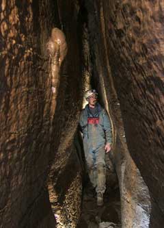
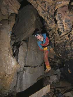
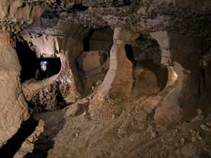
29 January 2008: The Knock on Wood Survey – Al Grimm, John Sweet and Phil Lucas – Report by Phil Lucas. Today it was mild for a change and the snow was soft as we descended into the Water Sinks sinkhole and down into the Subway. It is really getting to be a trade route down through the Sideways Passages and skirting around the Scary Room. The crawls through Slim Pickens seemed to be longer but perhaps that is because we made no detours along the way. Our mission today was to knock off the side leads we had left last time.
There is nothing spectacular to describe about today’s surveys. With the exception of about 70 feet of nice walking passage, the rest was crawlways of various sizes and descriptions. At least none of them had dragon diarrhea! In fact, they were all quite pleasant. (Now you gotta know, only a caver would say that.)
|
|
|
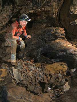
Al Grimm near the end of the Slim Pickens Passage, beyond station SP38. At right, a breakdown block that has been highly eroded, leaving many little fins of less-soluble material sticking out. Photos by Phil Lucas
|
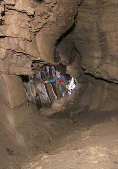
Well . . . there is one crawl, a dig really, that is quite interesting to me. It is a real passage about six feet wide in some places – maybe bigger. It is hard to say because it is mostly filled with small fine gravel, the size of rice cereal with just a bit of silt to hold it together – just barely. It fills the passage to within six inches of a nice arched ceiling. It was headed nearly south when we first made its acquaintance and had a definite flow of cool air (49°) to help dissipate the brow of a fevered digger. (Who says I can’t wax poetic.) It looked like a good prospect to me and I put in my share of digging (with the magic green digging tool) until twenty feet had been excavated to a place the floor seemed to fall away. Well, it didn’t fall very far – about six inches. There are places that six inches would be a lot but this wasn’t one of them. But it was enough to allow me to scoot ahead a few feet to get a better look. Growl, grumble, snort, the passage turned an abrupt left and continued onward for at least another ten feet and then out of sight in the same six inch high, six foot wide gravely crawl with that gentle breeze beckoning onward. The hour was late and rain was in the forecast to start this evening. Besides, we definitely needed a sled to start moving the spoils. So we stopped.
Al working in the Knock-on-Wood Crawl.
I think this is a good dig. The one-line plot shows it is generally headed toward the wet-weather stream course in Owl Cave where some of the flood waters disappear flowing toward Chestnut Ridge. I had started a dig in Owl about 18 years ago at this spot thinking. “What a good place to find more cave!” But after some digging I encountered rubble blocking the way. Having only regular explosives at the time but with no way to drill a hole, I had to back off this project until I could get a power cord into the dig site to plug in my big (and heavy) hammer drill with a one inch drill bit. To do this would require digging a new entrance into the cave down through a small sink not too far from this point. So I started digging on the sink. But somewhere along the way life intervened and I got waylaid. That project has been lying dormant ever since. But it has always been nagging away at me that maybe I have missed something by not digging there.
This Subway crawlway is headed right for that very spot! It is sixty feet away and fifty feet deeper. The Subway crawl (I think a good name is the Knock on Wood Crawl, KWC) is about 27 feet long and has the same rice-sized gravel throughout its length. How could this gravel been deposited so uniformly in the crawlway? First, I think the cave is back flooded from Aqua. When this happens, the KWC serves as an overflow tube (there must be several). The current through KWC is enough to carry finer sediments away but slight enough to sort the fine gravels throughout its length. If this is true then there is a good possibility that the crawl will intersect with cave passage beyond that connects to Aqua and perhaps Chestnut Ridge. Anybody interested in some digging? It is a pleasant dig.
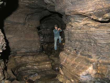
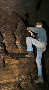
We surveyed 430 feet today. The Subway section of the Water Sinks now has 1.71 miles of survey and the entire cave has 2.2 miles. Owl Cave lies right over top of the Subway and has a length of .56 miles. So that is 2.75 miles of cave passages. Now the astonishing thing is that all this passage lies beneath roughly four acres, or a square about 515 feet on each side. A plan view of this shows a pattern of a dense maze – as dense as any large maze cave in Virginia. However and perhaps the most astonishing thing is that the cave does not seem to be a maze at all when one is exploring it. The reason for this is that the cave is developed on at least five levels that, for the most part, are distinct from one another. In fact, the old (previously known) Water Sinks Cave only connects to the Subway at the entrance, while Owl Cave is not known to connect at all! Also, there is a good variety in the types of cave passages: trunks, tubes, canyons, rooms, pits, ovals, keyholes, rectangular, vadose, phreatic, etc. These dispel the notion of a maze. In my experience it seems a most unusual cave.
There is a bunch of things to be done; digs to dig, water to trace, bugs to collect, minerals to examine, air to follow, geology to unravel and flood routes decipher. The number of going leads is dwindling but in a way this is a good thing because if the hill was found to be more hollow it might collapse! Of course all this will change when the next breakout occurs as I’m sure it will. I have got lots of reasons why it should and places to look. Let me bend your ear about it sometime. Phil
14 February 2008: The Swinging Bridge Survey – Keith Wheeland, John Sweet and Phil Lucas – Report by John Sweet. While not exactly a part of the Water Sinks, this is related because it is where the Water Resurges. We have been interested in determining the precise elevations of the sump of the Roaring River in the Subway and French Lake in Aqua Cave. While dye tracing has not yet been done, it is a virtual certainty that the Roaring River resurges at Aqua Cave.
A few weeks ago Bill Royster came to visit Phil and brought his company’s $29,000 Hiperlite precision GPS receiver along. It was not possible to get good reception at the entrances of Water Sinks and Aqua because of the steep cliff and narrow ravine, which block a broad view of the sky. Therefore, benchmarks were placed at Phil’s house and in the parking area by the swinging bridge over the Bullpasture River near Aqua. Data was collected for an hour at each location, then sent to the USGS for analysis. So we now know the lat/lon and elevation of those points to within 1.1 cm at Aqua and 2 cm at Phil’s. Phil has surveyed from his house to the Water Sinks survey datum and today we surveyed from the Aqua benchmark up to the cave entrance and back, completing a loop in order to have a measure of the accuracy obtained. We used tripod-mounted instruments and great care to get the best readings possible from cave-surveying equipment — a Suunto compass and inclinometer. Distances were measured with a laser measurer, so they should be correct within a few hundredths of a foot.
The survey from the benchmark to the cave entrance covered 1158 feet and the return route covered 1237 feet. Closure error for elevation was 1.4 feet, which is excellent over that distance. We think it is likely that most of the error is on the return leg. The straight-line distance from the benchmark to the cave is 1103.5 feet at a bearing of 308.18° from true north. The coordinates of the entrance are 38° 12.938'N and 79° 35.688'W, NAD27. The elevation is 1765.7±0.5 feet MSL. Phil has more data reduction to complete the survey from his house down to the Water Sinks. When that is done I will complete this report.
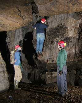
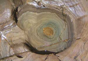
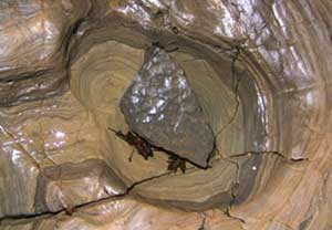
23 February 2008: Geological Investigations – Philip Prince, Ryan Thilpen, Summer Brown, Lisa Tranel, Ryan Grimm, Erik Haug, Nick Haug, James Spotila, Kristyn DeMarcio, William Rouso, Ben Schwartz, Scott Olson, and Phil Lucas – Report by Phil Lucas. A short trip was taken by the largest number of folks that have ever been in the Subway. This was Jim Spotila’s class from Virginia Tech plus Scott Olson and Ben Schwartz, who was the chief guide. The trip lasted about three hours and went only down to the Sweet Dreams and back. The purpose was to look at the geology.
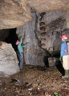
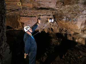
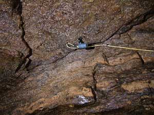
25 February 2008: Today I helped Frank Marks and Phil Lucas install two video cameras just above and just inside the entrance. These can be remotely controlled from Phil’s house. When the next flood comes along we should be able to post a video clip of the waterfall in the entrance drop. JRS
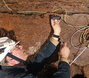
3 March 2008: Frank and Phil continued the camera installation, fine tuning the one inside the entrance and placing a third at The Big Rock. Heavy rains are forecast for the next couple of days so we are ready to watch the action.
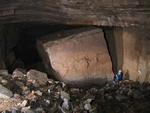
Frank installing camera #3 on The Big Rock.
|
|
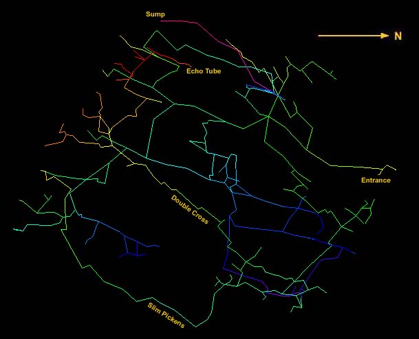
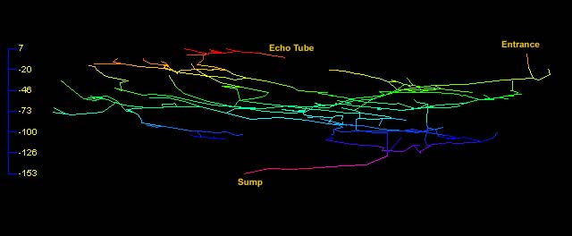
Line map of the Subway section of Water Sinks Cave after the 19 January [HH] survey, above, and profile below. It does not show the 22, 27 and 29 January [DD, HT, KW] surveys. The line colors represent different elevations within the cave.
|
|
The above maps were produced with Compass cave surveying software. Compass is a share-ware program that is well supported and costs $25 to purchase. Click the above Compass link if you would like to find out more about it and/or download it. If you are running Compass on your computer, you may download the data file for this survey and view it in much more detail. This data file includes the results of the latest surveys. Right-click this link and select “Save Link As” or “Save Target As,” depending on your browser. After downloading you must change the filename from "Subway.txt" to "Subway.dat" because some manner of error occurs when attempting to download a .dat file. Strange. Happy virtual caving!
J R S


Top of this page | Water Sinks Reports, 2007 | Return to Caving Page | Return to Home Page