Last Update: 17 January 2005
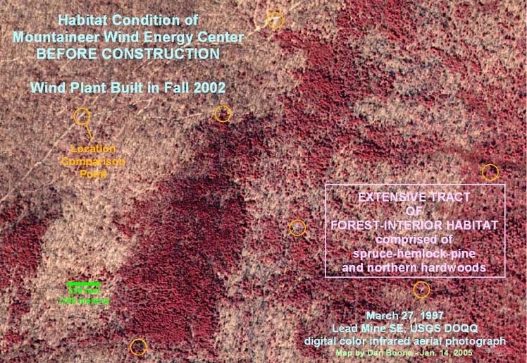
Site of a portion of the Mountaineer Wind Energy Center in 1997, five years before the start of construction. This is a digital color infrared photograph, which explains the odd coloration. The red areas are the conifer tree species (spruce, pine and hemlock) which are highly reflective of infrared light. The photo was taken during the winter so the brown areas depict the bare deciduous forest, mostly northern hardwoods — maple, birch, cherry, and northern red oak. The green bar at lower left is a 100m [328 foot] scale. This study area was chosen to compare before and after conditions, illustrating the impact of this type of development.

This is a post-construction photo in natural color covering the same area as shown above. The yellow circles are in the same locations as above to allow accurate comparisons. It is somewhat difficult to pick out the actual wind turbines but their prominent shadows are easily discernable. They are black lines pointing roughly NE except the two in the SW corner, which point WNW in this composite photo. The 44 turbines of the Mountaineer project were manufactured by NEG Micon and imported from Denmark. They are 345 feet tall and each turbine can generate up to 1.5 MW when the wind is blowing optimally. However, because the winds blowing over Appalachian ridges are intermittent and only occasionally ‘optimal’, a realistic estimate of the annual average generating potential for a 1.5-MW turbine in this region would be less than 0.5 MW, a 30% capacity factor.
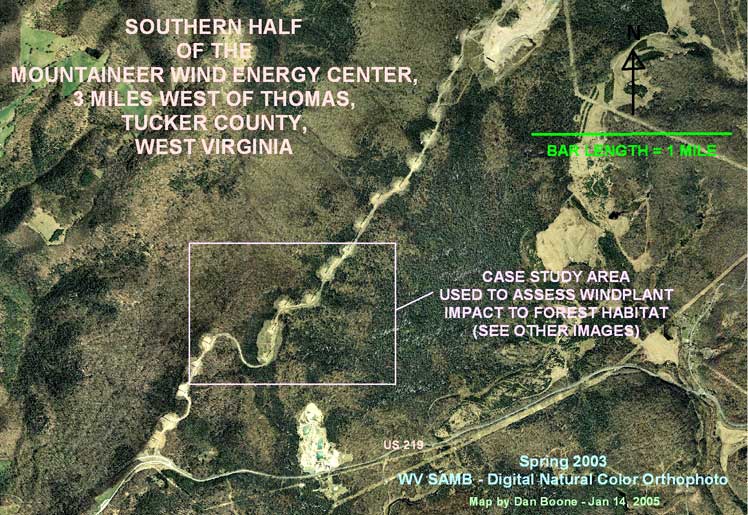
This is a wider view from the same photograph. The study area is shown by the rectanglular outline.
All of these photos have been reduced by 50% from Dan’s originals in order to make them reasonable for web display. If anyone would like the full-res versions for more detailed analysis please contact Dan Boone and ask him to send them.
Following is Dan’s commentary on these maps.
The first two images show the extensive forest-interior habitat that existed before the windplant was constructed and the resulting impacts following construction in late 2002. The third image shows the southern half of the windplant (about 22 turbines) and identifies the boundaries of the study area for the pre- vs. post-construction analysis. It also shows that the study area I chose was fairly representative of the existing habitat conditions at this windplant and gives a better view of the magnitude of the development’s impacts on forest and especially forest-interior habitat. [Forest interior is the type of habitat that exists at more than 100 meters from a clearing. Forest interior is required for the survival of certain species and is the type of habitat most easily destroyed by any form of development.]
On the portion of the site that I analyzed, the construction of this wind factory cleared over 42 acres of forest for the string of eight turbines (out of 44) that I analyzed. The extensive fragmentation of habitat resulting from the 50-ft-wide service road and the 5+ acres (average) that were bulldozed to erect each turbine caused the loss of over 150 acres of forest-interior conditions within this once-contiguous forest tract.
My estimate is that a complete analysis of the entire project area, including 5.5 miles of ridgetop and 44 turbines, would find a total of nearly 200 acres of forest were cleared and over 750 acres of forest-interior habitat was lost following construction of the Mountaineer wind energy facility.